from 0 review
Daily Tour
13 people
English, German, Turkish, Русский
Konya Tour 2025
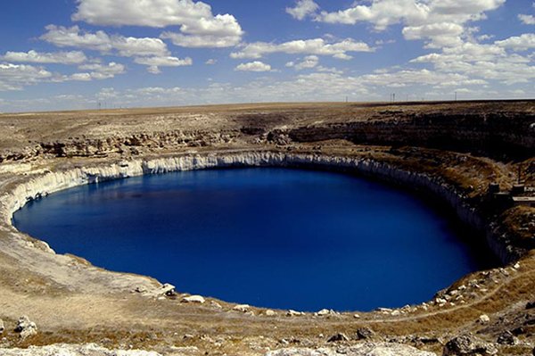
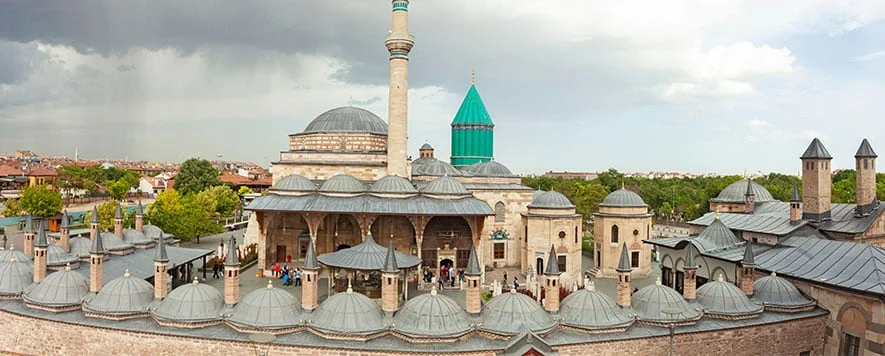
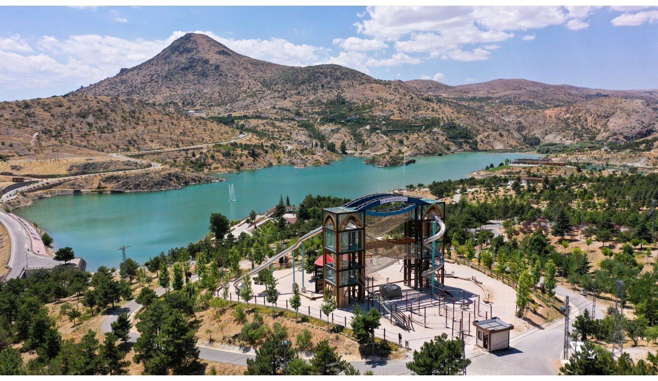
Getting to Know KONYA Konya is Türkiye’s largest province in terms of area and the seventh most populous city. According to 2013 data by Turkish Statistical Institute (TÜİK), Konya consists of 31 districts and has a population of 2,079,225. Its traffic license plate number is 42. Konya Municipality, established in 1875, gained „metropolitan“ status in accordance with Law No. 3399 enacted in 1987, and municipal services have been carried out according to this status since 1989. In 2014, with Law No. 6360, the boundaries of the metropolitan municipality became provincial administrative boundaries. Konya, one of the economically developed cities of Türkiye, is also important for its natural and historical riches. Çatalhöyük, one of the oldest settlements in the world, was inscribed on the UNESCO World Heritage List in 2012. The city served as the capital of the Anatolian Seljuks and the Karamanids. Konya, one of Türkiye’s most important industrial cities, is among the Anatolian Tigers. The city’s football team is TORKU Konyaspor. Among Konya’s symbols, the Mevlana Museum (Kubbe-i Hadrâ) and the double-headed eagle stand out. History: Konya has been a settlement since 7,000 BC, a cradle for numerous civilizations. Konya can be said to be among the oldest settlements in Turkey. Çatalhöyük in Çumra is known not only for its country but also for the world as the center where food culture first began, agriculture was practiced, fire was used, a settled life was adopted, and common defense against wild animal attacks was established. Çatalhöyük is a Neolithic center; Erbaba and Karahöyük are Chalcolithic; and Alaeddin Tepesi is an Old Bronze Age center. Throughout history, the Hittites and Lydians dominated Konya and its surrounding areas in the 6th century BC, the Persians in the 4th century BC, Alexander the Great, the Seleucids, and the Kingdom of Pergamum in the 2nd century BC, and Rome in 395 AD. The Sassanids temporarily occupied the city in the early 7th century, and the Umayyads under Muawiyah in the middle of the same century. A Byzantine province until the 10th century, Konya was subjected to raids by Muslim Arabs. Before the Battle of Manzikert, the first Turkish raiders to arrive in Konya were the Seljuks (1069). The conquest began a period of Turkish-Islamic rule in Konya. Konya became the capital during the First Crusade in 1097. Thus, a new page opened in Konya’s history, developing day by day, it was adorned with numerous architectural works and in a short time became one of the most developed cities in Anatolia. Konya remained the capital until the fall of the Seljuks (1308). Thereafter, it was governed by the Karamanids as the largest city of the Karamanid Principality. Fatih, who abolished the Karamanid Principality in 1465, established the Karamanid Province in 1470 as the fourth province of the empire, following the Rumelia (Sofia), Anatolia (Kütahya) and Rûm (Tokat) provinces, with Konya as its capital. Konya, which is among the most important cities of the Turks in terms of its historical monuments, is known for its role as the capital of the Seljuks for more than two centuries.It is adorned with monuments considered to be prominent works of Turkish architecture. Chief among these is the Mevlana Museum, considered a symbol of Konya. The Alaeddin Mosque, Sahip Ata Social Complex, Karatay Madrasa, İnce Minareli Madrasa, and Sirçallı Madrasa are works from the Seljuk period. Konya boasts numerous mosques, baths, fountains, bridges, dervish lodges, caravanserais, hospitals, aqueducts, and other infrastructure structures from the Seljuk and Beylik periods, and the Aziziye Mosque is the most well-known of the Ottoman-era structures. In the first half of the 12th century, during the reign of Sultan Alaeddin Keykubat (1219-1236) and later, Konya became a world center of science and art. Scientists and artists from all over the Turkish-Islamic world have gathered in Konya. Scholars, mystics, and philosophers such as Bahaeddin Veled, Muhyiddin Arabi, Mevlana Celaleddin Rumi, Sadreddin Konevi, Umsi Tabrizi, Qadi Burhaneddin, Qadi Siraceddin, and Urmemi prepared their valuable works in Konya, illuminating the world. This characteristic, which can be called „Konya’s Golden Age,“ continued until the mid-12th century. Nasreddin Hodja, with his humorous and thought-provoking anecdotes, was a wise man who played a role in the development of Konya’s cultural and social life for centuries. Konya has been within Ottoman borders since 1467. It was a stopover point for Ottoman sultans Yavuz Sultan Selim, Suleiman the Magnificent, and Murat II during their eastern campaigns. Scientific, cultural, and artistic movements continued uninterrupted. It was a center where famous poets, scholars, historians, and philosophers gathered. Architectural works such as mosques, fountains, madrasahs, and similar structures were constructed during this period. Geographical Situation: Konya province is located in the southern part of the Central Anatolia Region in the middle of the Anatolian Peninsula, in the Konya section of the city named after it. A large portion of its territory lies on the high plains of Central Anatolia. The southern and southwestern parts are included in the Mediterranean region. Its average elevation is 1,016 m. Administratively, it is bordered by Ankara to the north; Isparta, Afyonkarahisar, and Eskişehir to the west; İçel, Karaman, and Antalya to the south; and Niğde and Aksaray to the east. Konya province is naturally bordered by the Haymana Plateau in the north; the Cihanbeyli Plateau and Salt Lake in the northeast; Lake Beyşehir and Lake Akşehir in the west; the volcanic mountains, which formed along a fault line in front of the inner slopes of the Taurus Mountains, starting in the Sultan Mountains and continuing south of Karaman Province in the south; and the Obruk Plateau in the east. Groundwater is found at depths of approximately 20-100 meters in Konya and the surrounding plains of Çumra, Ereğli, Cihanbeyli, Akşehir, and Yunak, and in some places, this water forms artesian wells. The most extensive landforms in Konya province are plains and plateaus. Mountains: The elevations in the northern part of the province generally extend in an east-west direction. The most important are the Bozdağ Mountains. The mountain ranges located in the west of Konya extend from north to south.In the north are the Sultan Mountains (2,169 m), Aladağlar (2,339 m), Loras (2,040 m), Eşenler (1,951 m). The southern part of the region is bordered by the Taurus Mountains. Geyik (3,130 m), Bolkar Mountains (3,134 m) and Aydos Mountains (3,240 m) are located in this belt. Administrative and Socio-Economic Status Administrative structure: There are 31 districts and municipalities in Konya (excluding the metropolitan municipality). Population: The population of Konya province is 2,079,225 according to the results of the 2013 Address Based Population Registration System. Area: Located in the Western Anatolia Region, Konya is the province with the largest surface area in Türkiye. With a surface area of 41,001 square kilometers, it corresponds to 5.2% of Turkey’s total surface area. Districts: The largest districts in terms of population are Selçuklu, Meram, Karatay, Ereğli, Akşehir, Beyşehir, and Çumra, respectively. The largest district in terms of area is Cihanbeyli, while the smallest in terms of population is Yalİhüyük. Economic Agricultural activities form the basis of economic life in Konya. However, significant developments have also been made in industry in recent years. This has led Konya to shift from its image as a granary to an industrial center. Industrial activities in Konya are showing steady development. Konya 1st Organized Industrial Zone, which first became operational in 1976, was established on an area of 115 hectares with a workplace capacity of 150. Over time, the number of organized industrial zones in Konya increased to 9, while the total area covered by organized industrial zones increased to 2,686 hectares. Konya’s 2013 unemployment rate was 4.7%, the labor force participation rate was 48.4%, and the employment rate was 46.2%. Within the borders of Konya, there are Türkiye’s largest aluminum (bauxite) and magnesite deposits, as well as coal, clay, cement raw materials, lead-zinc, and barite mines, and significant groundwater reserves. Konya is the province with the largest total agricultural area. In 2013, its total agricultural area was 1,901,838 hectares. Of this area, 1,863,264 hectares is the total cultivated agricultural area, while the remainder is for perennial plants. Konya province ranks first in plant production with wheat, rye, barley, dried legumes, sugar beets, and grapes. It is also one of the leading provinces in the production of animal products such as red meat, eggs, and sheep’s milk. Social Structure The ratio of the provincial and district center population to the total population is 100%. The predominance of the young population in Konya province is striking. In 2013, 42.9% of the provincial population was under the age of 25. The population between the ages of 25 and 64 constituted 49.2% of the total population, while the population aged 65 and over constituted 7.9% of the total population. According to the Address Based Population Registration System data, the province’s population density of 53 is below the national population density of 100. Konya province’s annual population growth rate in 2013 was 13‰. In the same year, the literacy rate for the population over the age of 6 was 97.1%. It is understood that Konya province had a net migration rate of -1.9‰ in 2012-2013. Cultural Structure Konya has been home to a wide variety of civilizations,It bears traces of a history dating back to 7000 BC. It boasts a rich historical heritage with its archaeological sites, historical and natural protected areas, caves, and examples of civil architecture. The province, which also served as the capital of the Seljuk State, boasts significant tourism potential thanks to world-renowned figures such as Mevlana and Nasreddin Hodja. There are a total of 11 museums: seven in the city center (Mevlana, Karatay Tile Works, İnce Minare, Sırçalı Madrasa, Atatürk, Ethnography and Archaeology Museums) and four in the districts (Çatalhöyük Archaeological Site Museum, Ereğli Museum, Akşehir Western Front Headquarters Museum, and Akşehir Archaeology Museum). Additionally, there is the Regional Manuscripts Library and the Yusuf Ağa Manuscripts Library, where our national culture is preserved.
Member Since 2025
 Čeština
 English
  Deutsch
  Polski
  Русский
  Türkçe
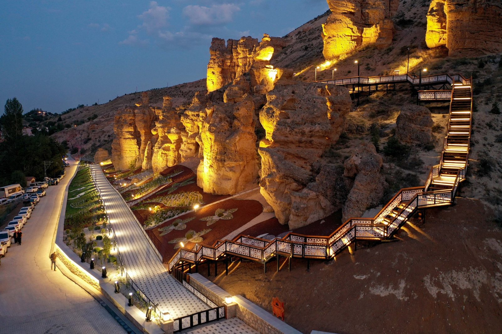
Leave a review